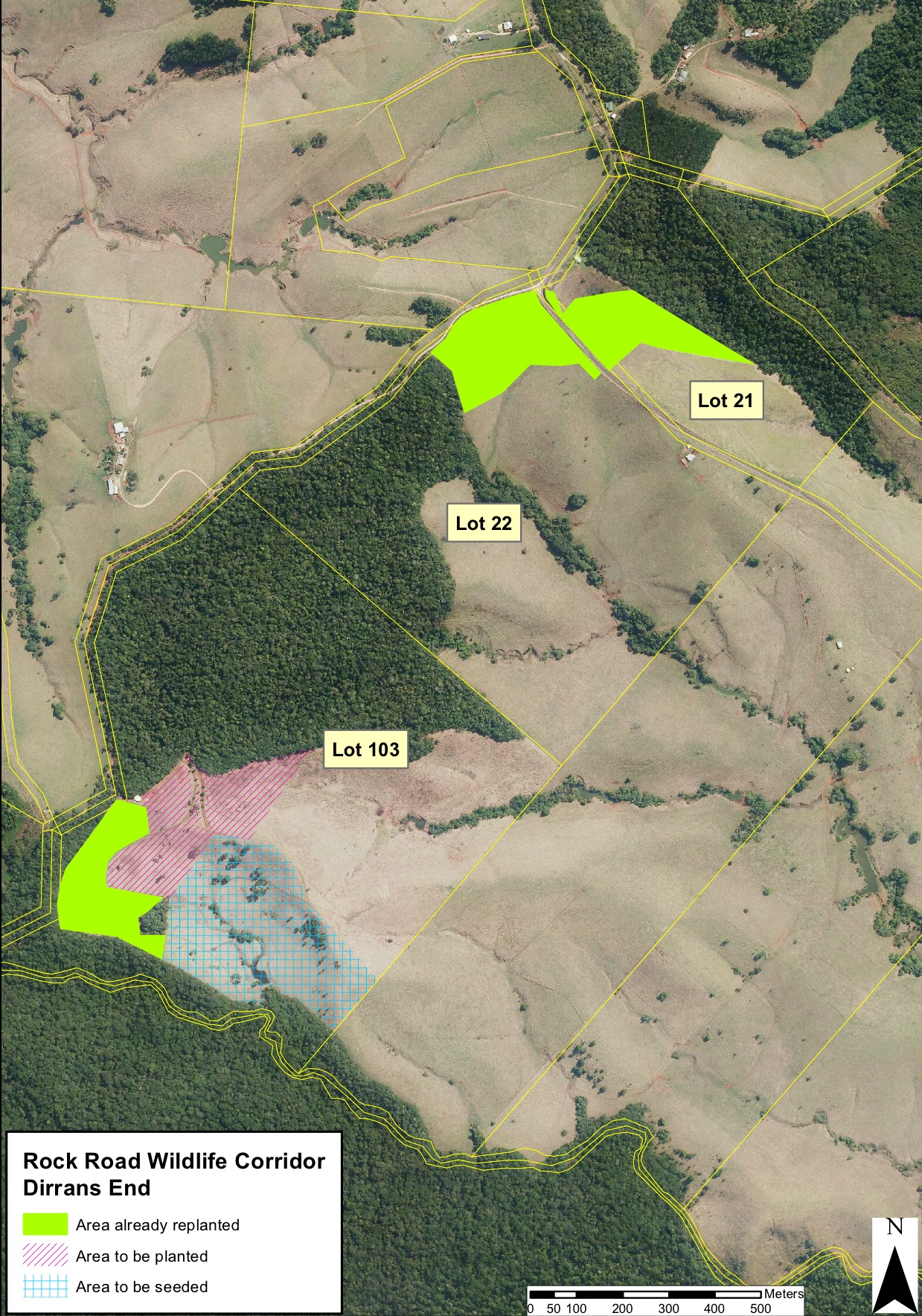
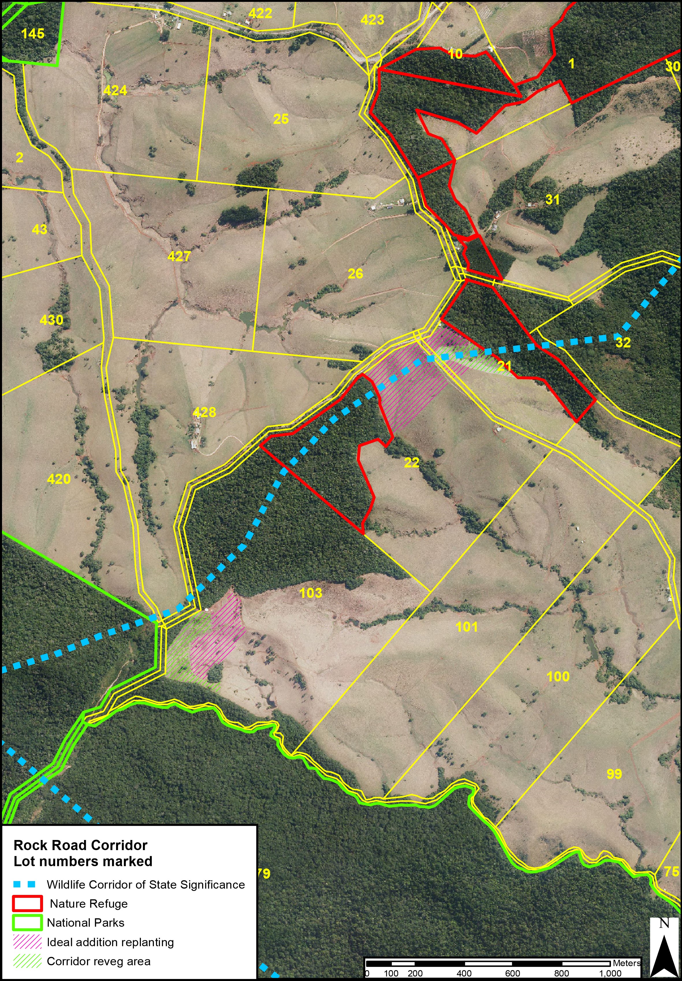
Dirrans End Maps Click on the maps below to view larger picture ... | | Aerial image to the left shows Dirrans End (Lot 103) and the Rock Road Wildlife Corridor. Four hectares of rainforest has already been replanted on Dirrans End and our current priority project is to plant another eight hectares as shown by the purple hatched area on the map. Aerial image to the right shows the general position of the Rock Road Corridor. Dirrans End is Lot 103. The World Heritage area is to the south and the Hypipamee Outlier to the north. | 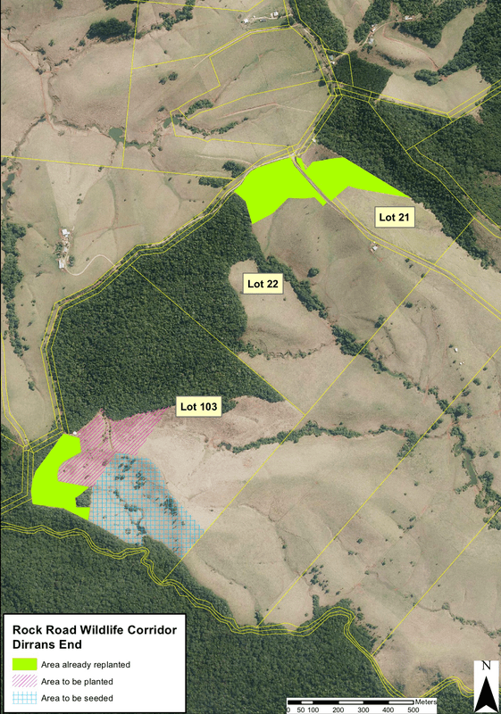 | 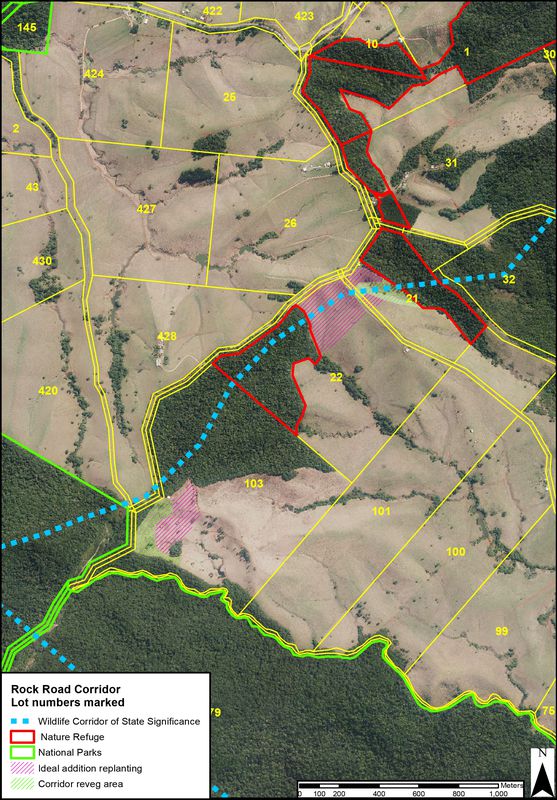 | Rock Road Wildlife Corridor | Rock Road Wildlife Corridor | |